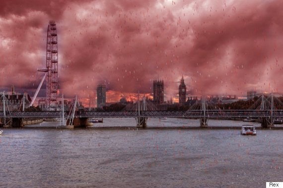
Parts of Britain are set to be tinted a rusty red this weekend amid forecasts of ‘blood rain’.
As apocalyptic as it sounds, it’s not quite time to prepare for the end.
The phenomenon is caused when an influx of Saharan red dust and sand from the deserts of North Africa mixes with rain, creating a rosy-hued precipitation.

The blood rain is unlikely to look like this... BUT IT COULD
When it dries it leaves a thin layer of red dust, coating cars, furniture and anything else you may have left outside a sooty claret.
Dr Steven Godby, a geographer at Nottingham Trent University told HuffPost UK: "Dust events like this are not uncommon in the UK and we witnessed one contribute to extremely poor air quality in parts of the country a year ago under similar synoptic conditions.
"The dust is produced from source areas in North Africa, incorporated into a northerly airflow and can travel long distances before being deposited as far away as the UK.
SEE ALSO:
"However, the events we experience are small scale compared to those experienced closer to major dust sources. Just last week a major dust storm swept across the Arabian peninsula, affecting travel and air quality before passing over the Arabian Sea and causing a major pollution alert in Mumbai, India.”
Experts have warned the dust could also cause spikes in air pollution, causing smog to build over Britain.
Asthma sufferers and older people are being advised to "reduce physical exertion" particularly while outdoors, as the air becomes more dense with pollutants.
Copy continues below...
Dr Sotiris Vardoulakis, head of the air pollution and climate change group at Public Health England's Centre for Radiation, Chemical and Environmental Hazards, said: "While most people will not be affected by short term peaks in air pollution, some individuals, particularly those with existing heart or lung conditions, may experience increased symptoms."
The Department for Environment, Food and Rural Affairs (Defra) has warned of spikes in air pollution across central, eastern and northern England.
Additionally, with summer seeming to come early for many this week, doctors have reported seeing hay-fever sufferers experiencing symptoms.
While the pollen levels are moderate for much of the south of England and low for the rest of the UK according to the Met Office, many people are already suffering from hay-fever symptoms.
Andrew Williams, nurse consultant at Homerton Hospital, east London, told the Daily Express: "People have already been coming in with symptoms triggered by the London plane trees.
"Now we are seeing high birch pollen levels, a lot of sufferers are presenting slightly earlier than usual as the problem gets worse."
The country could enjoy the hottest day of the year so far today as temperatures are expected to soar to 22C (71.6F), making parts of it warmer than Greece and Turkey.
The mercury is set to peak in parts of eastern England, making it warmer than the 6C (42.8F) forecast for Ankara and 17C (62.6F) in Athens.
However Brits should not pack away their umbrellas and raincoats just yet, as temperatures are expected to become more seasonal by tomorrow, with a band of rain expected overnight.
Met Office meteorologist Charles Powell said today's weather may be a shock to the system after a week of uncharacteristically warm temperatures.
He said: "On Friday we could see temperatures of up to 22C (71.6 F) across parts of eastern England, particularly to the north of London and into Cambridgeshire.
"But by Saturday morning temperatures will be lower after a band of rain overnight.
"But it's not that it's going to be particularly cold, it's just returning to nearer normal after a week of temperatures being above average, so it will feel slightly colder."
On Saturday temperatures of around 10C (50F) or 11C (52F) will be seen in the North and around 14C (57F) or 15C (59F) further south, providing some cooler air for spectators and competitors in the Grand National and the Boat Race.