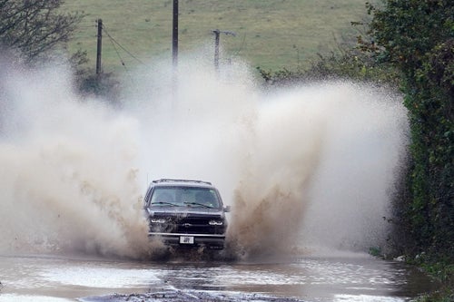

Storm Ciarán has swept across northwestern Europe today, causing travel disruption and leaving millions without power.
It has triggered a record low for sea pressure levels around England and Wales, and a red weather warning for the Channel Islands.
The BBC has also reported windows being blown in by the storm and said a roof had been ripped off a house on Jersey.
School closures have already been announced on the island as winds have reached 104mph. Forty people have been evacuated from their homes due to damage.
Outside of the UK, 1.2 million households have been left without power in France and a red weather warning is in place in Spain.
Authorities in the French peninsula of Brittany have also encouraged people to remain indoors, at home, and avoid the winds as they crept up to 129mph, with 66ft waves off the coast.
Ciarán comes two weeks after Storm Babet, which came in from the Atlantic and was accompanied with heavy rain and winds. It caused intense flooding in Northern Ireland and the UK.
While there are fears this new storm could last for three days, Meteo France weather service has just downgraded its alerts for strong winds in Mache, Finistere and Cotes d’Armor from red to orange.
Dutch Airline KLM also cancelled flights going to and from Amsterdam. International trains from Amsterdam to Paris were also halted.
The Met Office noted that the storm came off the back of “what was provisionally the joint-sixth wettest October on record for the UK”.
The weather experts noted there’s evidence to suggest the intensity and frequency of windstorms in British winter could be increasing due to climate change – although the data is inconsistent.
It added: “Storm Ciarán is a fairly normal Autumn storm for the UK, and due to the natural year-to-year variability in strong winds and windstorm numbers, significant trends have not been detected in observations over the recent climate.”
Royal National Lifeboat Institution’s (RNLI) water safety manager Ross Macleod warned: “This rough weather could make visiting our coasts around southern England and Wales treacherous and bring very dangerous sea conditions.”
Here’s a look at some of the most jaw-dropping clips circulating on social media capturing the storm: