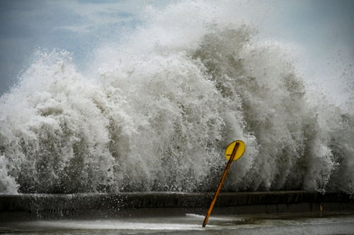

Hurricane Ian has swept through Cuba and is now heading to the US state of Florida, expecting to bring a major threat to life.
The category four storm is likely to bring storm surges, strong winds, floods and landfall in the southern part of Florida’s Gulf Coast by Wednesday.
It caused chaos already in Cuba – where 11 million people were initially left without power – and severe flooding was seen in Florida Keys, although no fatalities had been reported by Tuesday night.
But it’s expected to get stronger as it moves over the warm Gulf of Mexico.
Florida governor Ron DeSantis has warned that it is on the cusp of becoming a category five storm, which is the highest classification available. There have only been two storms of that strength in the US for the last three decades.
The National Hurricane Centre predicts that the storm will be a major hurricane when it approaches the Florida shore on Wednesday, before turning into a tropical storm by the time it moves over the state by Friday.
On Saturday it’s estimated to become a tropical depression over South Carolina, before becoming calmer around North Carolina.
While the images from the areas already hit by the storm are deeply alarming, NASA has captured some even more terrifying photos showing the strength of the hurricane as it sweeps across central America – and moves onto southern States.
The International Space Station will also be providing live coverage of the storm this week.
The wind speed at the moment is around 155mph and 40,000 power cuts have already been reported, and it’s only worsening.
Locals fear it will hit Tampa Bay, a region particularly prone to flooding because of its low elevation. It also has rising sea levels and a large population, risking a tidal surge.
Theme parks including Disney World in Tampa have closed as a result, and many citizens have been urged to evacuate.