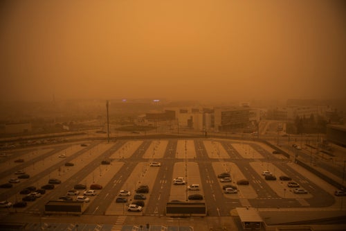

“Blood rain” is forecast to hit the UK this week as thunderstorms and dust combine to create a rather foreboding effect.
What is this unusual phenomenon?
The Met Office points out that this is when red coloured dust or particles in high concentration mix with rain, turning the droplets into an orangey shade.
It’s scientifically known as wet deposition, but more commonly known as “blood rain”.
The dust can trigger reduced solar energy production and slightly lower surface temperatures, as it reflects the sun’s light away from the ground.
What else should we expect?
Forecasters have predicted that not only will the rain change colour but there will be lightning, winds and hail. A yellow storm warning has been issued from Wednesday evening until the early hours on Thursday in the south-east, as the Met Office has warned people should expect travel disruptions.
This includes cancellations to train and bus services, flooding to homes and businesses, power cuts and damage to lightning strikes. Sudden flooding might be on the cards, too, due to the thunderstorms.
Wind and some heavy rain is expected to arrive in Northern Ireland and north west Scotland too, while showers will hit Wales, and central and south-west England.
It’s a sharp contrast to the high temperatures seen on Tuesday, when the south-east enjoyed the hotted day of the year so far at 27.5C.
But, it’s not all bad
RIchard Miles of the Met Office told PA: “There are some dust concentrations in the atmosphere above the UK at present which might well be washed out in the rain tonight, but it’s likely to be relatively small amounts on the whole.”
He added: “Away from these features it will be mostly fine and dry today and tomorrow, temperatures up to 23-24C in London and the South East, high teens or low 20s elsewhere.”
Has this happened before in the UK?
Yes – only two months ago.
In mid-March, the sky turned an ominous yellow-orange colour. This was actually a sign of a huge sandstorm which arrived in parts of England this week, having been transported more than 1,500 miles in from the Sahara Desert by a weather front.
It was part of Storm Celia, which brought strong winds, hot air and travel disruption to the Canary Islands before moving eastwards to Spain, Portugal and France.
Spanish officials even warned the public to wear face masks and avoid going outside if possible due to the depleted air quality, although the dust amounts reaching the UK were significantly lower.
According to the Met Office, the dust lingered approximately two kilometres above ground level in the UK, but some fell to the ground when it rained.
Photos shared on Twitter revealed just how Storm Celia impacted the UK at the time:
While undoubtedly spooky, the scenes pictured across Europe were even more alarming. The dust reportedly reached the snow in the Alps too, tinting it orange.