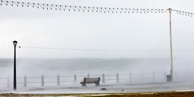
As icy rains flooded Western Cape over the weekend, the rest of the country is gearing up for an intense cold front over the next few days. Gauteng temperatures are expected to drop rapidly from Monday, while Western Cape will have some relief from the wet weather.
Parts of Cape Town experienced heavy flooding thanks to the rains over the weekend, with the city's management blaming the problem on blocked stormwater drains.
The city's informal settlements were hardest hit by the floods, reported the Cape Times. It said residents from places such as Pholile Park, Masakhane and Simanyene were offered temporary housing in a local hall, but many refused, claiming that their belongings had been stolen in the past when they abandoned flooded homes.
Residents reportedly complained that the floods happen annually, ruining furniture, food and homes.
Mayoral committee member for transport Brett Herron said in a statement that the havoc wrought by the rains, especially on the city's roads, was thanks to blockages in the stormwater system, News24 reported.
"This could be caused by loose debris on the road surface that had landed in the opening of the gully causing a blockage. One of the other causes of blockages is debris that is dumped into stormwater infrastructure," Herron explained.
The most traffic-affected areas include Kudu Avenue in Lotus River, Crescent Road on the corner of Claremont Avenue, and Main Road in Somerset West.
Louw Avenue in Grassy Park, Fernwood in Newlands and Carel Uys Road in Atlantis have also been affected.
Flooding was also reported in Khayelitsha, Macassar, Philippi, Gugulethu, Kraaifontein and Maitland, as well as Parow, Goodwood, Ravensmead, Uitsig, Woodstock and Elsies River.
"Our teams are on high alert and are attending to the incidents as we become aware of them. We are also working in close collaboration with other city departments," Herron said.
"The roads and stormwater departments are clearing roadways and unblocking drains. I urge motorists to take extra care or where possible delay non-essential travel."
From Monday night, Gauteng residents can expect a significant drop in temperatures thanks to the cold front, Eyewitness News reported.
Forecaster Victoria Nurse said the cold front will arrive in Gauteng on Tuesday, and temperatures will warm slightly on Thursday.
According to News24, the weather will bring extremely high fire danger conditions to eastern Free State and central and north-western KwaZulu-Natal. Gale-force winds are expected to hit Cape Agulhas and Port Edward, and snowfall is expected over southern Northern Cape and Western Cape winelands.
Snow is expected in parts of Eastern Cape, while Bloemfontein is expected to reach a high of just 8ºC over the coming days.
