Wildfires that have forced nearly 200,000 people to evacuate the Los Angeles area aren’t just leaving their mark on California, but on the rest of the planet.
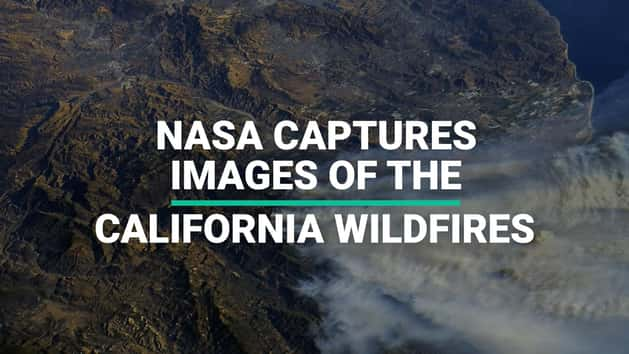
NASA astronauts aboard the International Space Station (ISS) confirmed that the devastating scenes unfolding are visible from outer space, as they released a series of shocking images that reveal the extent of the devastation.
Smoke plumes are visible at roughly 65,000 feet, as well as burn scars scattered across the Californian landscape.
On 6 December American astronaut Randy Bresnik said: “I was asked this evening if we can see the SoCal fires from space. Yes Faith, unfortunately we can. May the Santa Ana’s die down soon.”
The fast-moving blazes are being fueled by the strong Santa Ana winds, which have made it increasingly difficult to get them under control. The winds, which blow in hot and dry from the California desert, reached hurricane-force speeds of 75 mph on Thursday.
Bresnik added: “Thank you to all the first responders, firefighters, and citizens willing to help fight these California wildfires.”
He also shared an update 24 hours later, saying that the fires did not look like they were slowing down.
Russian astronaut Sergey Nikolayevich Ryazansky also shared some images of the rising smoke plumes.
The wildfires prompted officials to send an unprecedented warning to 12 million residents, about the risk to life. The state’s Office of Emergency Services sent the broadest alert ever in their history, deputy director Kelly Huston told the Associated Press.

