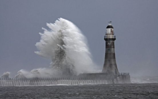
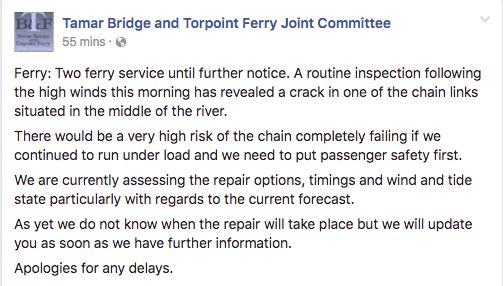
Storm Doris has reached nearly 90mph in her haste to batter Britain - and has sinisterly morphed into a ‘weather bomb’ along the way.
Having rapidly deepened over the last 24 hours, the storm has undergone a process called explosive cyclogenisis, forcing violent winds from the system known as ‘bombs’.
Travel disruption, damage and flying debris were on the menu from 6am, when she officially set in, the Met Office warned.
By lunchtime, all west coast services out of London Euston station had been cancelled and travellers were asked to avoid the station if possible.
Heathrow Airport also warned of some delays and cancellations.
A spokesman said: “Strong winds and poor weather across the UK have resulted in approximately a 10% reduction to Heathrow’s flight schedule.
“With Heathrow operating at more than 99% capacity, there are no gaps in the schedule that can be used for delayed flights and as a result, some passengers may experience disruption to their journeys today.”
An 87mph gust was recorded at Mace Head on the Galway coast in the Republic of Ireland in the early hours as Doris made its way east.

The UK was being battered by gales in the early hours, with speeds of 55mph being recorded at The Needles in the Isle of Wight.
Britain is expected to be battered with winds of up to 80mph at the storm’s peak and Highways England has issued a weather alert on major roads.
Particularly at risk are high-sided vehicles, caravans and motorbikes and drivers are “strongly advised” to avoid travelling on some stretches of road in Yorkshire, the Midlands, and the East and North West.
Richard Leonard, head of road safety at Highways England, said: “We’re expecting Storm Doris to have a significant impact on the roads throughout the day so are urging drivers to consider changing their plans if necessary and to slow down in stormy weather.
“Drivers should look out for warnings on the electronic message signs and listen for updates in radio travel bulletins.”
Amber warnings predict strong winds and heavy rain in parts of north Wales, the Midlands, and the East and North West, while winds as fast as 60mph are also expected to batter southern England.
Meanwhile, up to 15cm of snow could fall across parts of Scotland and north-east England in treacherous, blizzard-like conditions.
Weather warnings have been upgraded to amber across Scotland’s central belt, the Borders, Dumfries and Galloway, Tayside and Fife.
“We have got a fairly active area of low pressure coming in from the Atlantic,” said Met Office forecaster Emma Sharples.
“It is strengthening as it moves eastwards to the UK.”
The Met Office’s amber weather warning alerts people that “whilst the strongest winds look to be only short-lived, damage to structures, interruptions to power supplies and widespread disruption to travel networks are likely, with a danger of injury from flying debris”.
It’ll be a flying visit however, with the worst of the weather gone by Thursday evening.
While further Atlantic gusts will bring more rain and wind through the weekend and into next week, they are not expected to reach the heights of Doris.
AA spokesman John Snowling said: “The unpleasant combination of torrential rain, severe gales and heavy snow will create some very poor driving conditions, with the potential for roads to be affected by black ice, debris or standing water.
“Wind can also bring down tree branches, blow you off course or blow other vehicles into your path.

“Expect travel disruption as some roads will be treacherous.”
Anyone affected by power cuts during the storm is encouraged to dial 105 for further information.
Storm Doris’s appearance contrasts with Monday’s temperatures, where visitors to Kew Gardens, west London, enjoyed the warmest day of the winter so far, at 18.3C (64.9F).
Parts of London and the South had temperatures warmer than Ibiza, southern Spain and Menorca.
