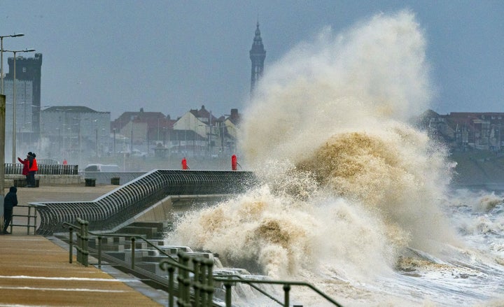
The Met Office has just issued a red weather warning ahead of Storm Eunice – meaning it is very likely to have a high impact on the UK on Friday.
Eunice follows Storm Dudley, which rocked parts of north east England and Scotland on Wednesday.
But Friday’s weather is expected to be significantly more severe, especially considering the Met Office has just upgraded its warning from amber to red.
No.10 has just announced it will be holding an emergency COBRA meeting (the civil contingencies committee which handles national disruption) on Thursday to address the impact from Dudley and how to mitigate the effects of Eunice.
So what should we expect?
The Met has explained that a red warning means we should expect “significant disruption and dangerous conditions” due to Eunice’s strong winds.
A red warning means: “Dangerous weather is expected and, if you have not done so already, you should take action now to keep yourself and others safe from the impact of the severe weather.
“It is very likely that there will be a risk to life, with substantial disruption to travel, energy supplies and possibly widespread damage to property and infrastructure.”
It means flying debris could pose a danger to life, while damage to buildings and homes (where roofs could be blown off or power lines brought down) is also a possibility.
Trees may be uprooted, while roads, bridges and railway lines may close triggering further delays and cancellations to all travel services.
Powers cuts could affect mobile phone coverage.
Closer to the coast and sea fronts, large waves should be expected to hit the shore, potentially pushing beach debris onto roads and into coastal homes.
Flooding of properties near the shore is also a high risk.
The Met Office previously issued an amber alert for southern England and Wales, warning of 60-70mph wind gusts. In some areas, particularly around the coast, this wind could even reach up to 100mph.
Where does the red weather warning apply to?
Southwest England along with south Wales are likely to experience the most disruption.
This includes Bristol, Cornwall, Devon, Gloucestershire, Isles of Scilly, North Somerset, Somerset and South Gloucestershire.
In Wales, Bridgend, Caerphilly, Cardiff, Carmarthenshire, Monmouthshire, Neath Port Talbot, Newport, Rhondda Cynon Taf, Swansea and Vale of Glamorgan will be affected too.
The storm to set to begin from around 7am on Friday. As of Thursday, it has already started to develop across the Atlantic Ocean on its way to Europe.
However, winds are expected to ease from the west around late morning in the UK and the red warning is likely to be lifted around midday.
Why it’s worth paying attention to this forecast
Meteorologist John Hammond told LBC: “I think we’ll be talking about this storm in years to come, that’s a measure of how rare and how severe it’s going to be.”
He recommended anyone who wants to travel on Friday to get in touch with train operators as “there will be substantial suspension” of most services.
He urged people not to travel at all if they can help it due to the “concoction of severe weather” set to hit the UK.
Hammond concluded: “Don’t be lulled into a false sense of security that this is just another weather warning from the Met Office. This one does mean business.”
It’s not just a red warning either...
An amber warning across the East Midlands, East of England, London, South East England, North West England, South West England, Wales and the West Midlands will not lift until 9pm.
This warning is for extremely strong winds on Friday too, but means that there is likely to be a little less disruption compared to the areas under a red weather warning.
A yellow warning is in place from 3am on Friday to 6pm for snow in Scotland, North East England, North West England and Northern Ireland, which could affect travel.
Rural communities could be briefly cut off due to power cuts and travel delays on the roads.
The Met has clarified that “not all areas within the warning area are expected to see snow”, but some inland places could see up to 5cm of snow.
Strong winds occurring at the same time in some of these areas could lead to poor visibility and blizzard conditions.
