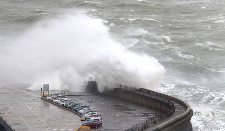
Storm Gareth’s strong gales and heavy rain have been causing disruption, with rail and road links across the country affected.
The Met Office has issued two yellow warnings for high winds covering Northern Ireland, Wales, most of England and the west coast of Scotland.
Gusts of up to 75mph were recorded in Scotland on Tuesday night, while winds of over 60mph were seen widely across western parts of the UK in the early hours of Wednesday.
Storm-force winds created “atrocious” conditions for an operation to rescue six crew from a French fishing vessel off Land’s End.
Two RNLI lifeboats launched after the alarm was raised at 10pm on Tuesday, but waves of up to 20ft meant it was “impossible” for a tow line to be attached and the crew were air-lifted off by the Newquay Coastguard Rescue Helicopter.
Storm Gareth is expected to continue moving across the country throughout the day, with the worst of the winds occurring in the early hours before gradually easing later on in the afternoon as the storm moves out to the North Sea.
Transport links were at risk of being impacted as the squally weather blows through.
Commuters using trains in Wales, Scotland, the north of England and East Anglia were warned that services could be disrupted by high winds during the morning rush hour, with speed restrictions in place across a wide area.
Trains between Durham and Newcastle were halted until at least 9am after overhead electric wires were damaged, impacting LNER, CrossCountry, Northern and Transpennine Express services.
Meanwhile, some Virgin Trains services between Manchester Piccadilly and London Euston and some trains between Glasgow Central and Preston were cancelled.
There were also reports of trees blocking roads and some exposed routes in the north-east of England being closed to high-sided vehicles.
At the Cheltenham Festival, punters were advised that organisers would be holding a precautionary inspection in the morning, although officials later gave the go-ahead after winds eased.
Met Office forecaster Alex Burhill said: “We’ve got some very strong winds. The strongest in the morning rush hour are probably going to be around Northern Ireland and also western coastal parts, particularly western Scotland and north-west England.
“Eastern areas might start getting some very strong winds by that point, but generally across much of the UK it’s going to be very windy this morning.
“People need to be aware that there could be some travel disruption because there could be delays to things like ferries and aircraft and also bridges may need to be closed.”

Heavy showers with some thunder were also expected across the northern half of the UK as the storm moves across throughout the day.
Dozens of flood alerts have been issued by the Environment Agency in England, including two warnings for the River Ouse at York.
Storm Gareth swept in across Northern Ireland on Tuesday, causing problems on the roads with fallen trees and the cancellation of ferries.
Met Eireann, the Irish Meteorological Service, also warned of “severe and damaging gusts” as the storm moved over the country.
The storm is expected to have moved out into the North Sea by Wednesday evening, although another band of wet and windy weather is expected to arrive from the west on Wednesday night.