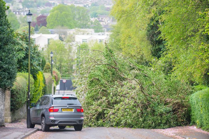
Storm Hannah is gradually blowing itself out after battering Wales, Northern Ireland and the west of England with winds of more than 80mph.
A spokesman for the Met Office said weather stations were still recording gusts of 60-70mph, but the storm is easing as it moves eastwards.
A band of rain continues to hammer Northern Ireland, with another 10mm expected on top of the 20mm already seen.

A yellow weather warning remains in place over the country, meaning the flooding of some homes and businesses is “likely”.
Overnight, the storm battered western parts of the UK.
The Llyn Peninsula saw the strongest winds when a gust of 82mph was clocked at Aberdaron.
Meanwhile, a gust of 78mph was recorded at Pembrey Sands in Carmarthenshire and a 64mph gust was observed at the Needles off the Isle of Wight.
Western Power Distribution said more than 1,700 customers had been left without power on its network on Saturday morning, with the majority of those affected in Wales.
A spokesman said that by midday almost all had had their power restored, but the network could see pockets of disruption until the wind eased off completely.
A yellow wind warning covering Wales and central and southern England is in force until 3pm due to the threat of further power cuts and disruption to transport networks.
Transport for Wales said storm damage on the Conwy Valley line meant buses were replacing trains between Llandudno Junction and Blaenau Ffestiniog.
There were cancellations after a tree fell on the line between Abercynon and Quakers Yard, but all lines have now reopened.
Met Office forecaster Simon Partridge said: “It’s a gradually improving picture as we go through the afternoon.
“Storm Hannah is gradually moving south east so it has pretty much already cleared the south west of England so it’s much drier and brighter now with just a few showers around.
He added: “By the evening the winds will gradually ease but it will be a pretty wet and windy day.”
Partridge said those running the London Marathon could expect a chilly start.
“The London Marathon will be fairly breezy, pretty cloudy and with a chance of a few showers while the runners are lining up and getting ready,” he said.
The morning will be gloomy and grey, but slower runners could feel the sun on their backs.
“We could see sunshine breaking through in the afternoon and we could see highs of 14C (57.2F) – 16C (60.8) tomorrow – much warmer than today, but nowhere near the record breaking heat we saw last year,” he said.
In 2018, the mercury hit 24.1C (75.3F) on the day of the marathon.
Named by the Irish weather service Met Eireann, Storm Hannah hit Ireland’s south-west on Friday.
The highest recorded winds were at Mace Head in Galway, where 76mph was observed, while gusts reached 74mph at Shannon Airport.
Overnight, the service warned people to exercise “extreme caution,” particularly close to the Munster coastline.