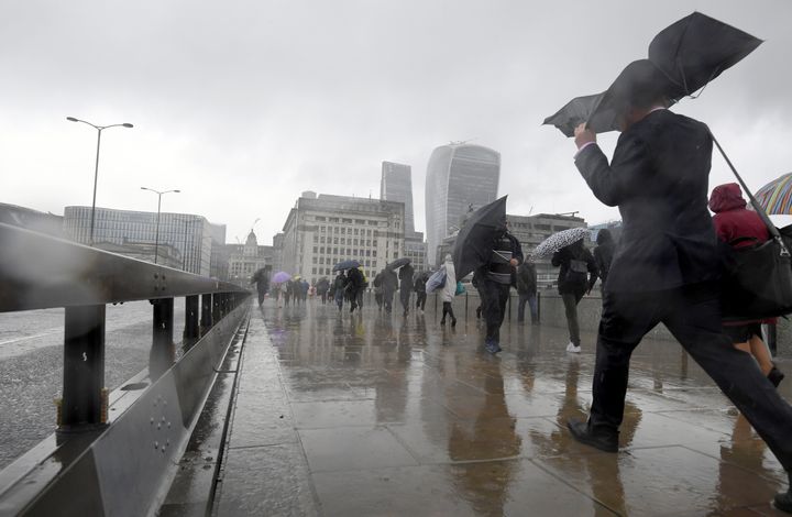
Brits were cracking out the shorts and suncream last week as we basked in glorious sunshine - but it’s all come to a very soggy ending this week.
Commuters travelling to work on Tuesday battled the elements, to the point where #rain was trending all morning on Twitter...
And unfortunately, it’s not over yet.
Heavy rain is forecast in the north and east of the country, while the rest of us will be enjoying showers and blustery conditions.
The Met Office has also issue a number of yellow “be aware” weather warnings.
Rain warnings, covering a number of areas in Scotland, are in place, with the possibility of 25 to 50 mm rain in 24 hours over northern and northeastern Scotland, and 50 to 75 mm rain over some areas of high ground where locally close to 100 mm may fall.
Wind warnings were also in place in many areas of England until midday.
It comes after the Met Office shot down tabloid reports of a “blowtorch summer” on Monday.
While early statistics show both May and spring have been warmer and sunnier than average, the Met Office says suggestions July will be embellished with 35C blasts of searing heat are inaccurate.
Weather Outlook forecaster Brian Gaze had earlier alleged: “35C highs would not be a surprise ahead. A ‘blowtorch’ pattern with several shots of hot air from southern Europe is expected.”
But forecaster Emma Sharples of the Met Office told HuffPost UK: “It’s looking like a mixed bag for June and while that doesn’t preclude the chance of some hot spells, we’re not seeing anything to suggest heat of that nature.”

Sharples added: “A ‘blowtorch’ pattern is not a meteorological term and it is impossible to look that far forward.”
The Met Office provides a maximum 30-day forecast, with predictions for mid-June to July looking mixed, with some rainy showers and some “warm or even hot interludes,” though nothing as specific as the 35C highs claimed.
