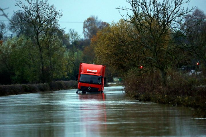
After enduring record-breaking rain, some flooded communities have woken on Monday to a sudden drop in temperatures – with many parts of the UK falling far below freezing overnight.
News that conditions are expected to stay largely dry over the coming days has come as some relief, however residents slowly returning to their homes after being forced out by the rain will now have to deal with freezing temperatures.
Temperatures plummeted over Sunday night, with the lowest recorded temperature recorded at -8.1C in Tulloch Bridge in the Scottish Highlands, however across large parts of the UK the mercury struggled to rise above freezing.
Parts of the Midlands and South Yorkshire which have been hit the hardest by flooding now face temperatures of -4C.
The village of Fishlake, near Doncaster, which has been devastated by the recent floods, could see lows of -1C on Monday, whilst Matlock, Derbyshire, – close to where the body of former High Sheriff of Derbyshire Annie Hall was found after being swept away by floodwater – is expecting lows of -3C.
In both places the maximum temperature is expected to be just 6 or 7C, with cold conditions expected across much of the UK.

A yellow weather warning for ice has been put out by the Met Office in the far north of Scotland, with meteorologists warning of potentially dangerous driving conditions.
The sunshine is expected to hold over large areas of the country, once the fog has lifted in the north, with the Met Office predicting just a few showers in the far north and east.
Overnight on Monday temperatures will drop significantly, becoming cold and frosty with widespread fog across central parts of England.
The fog could be slow to lift on Tuesday across central and eastern England, where it will be cold, but whilst most areas will be treated to another sunny day, clouds and wind will gather in the west bringing rain.
A total of 51 flood warnings and 86 flood alerts remain in place on Monday morning, with the number slowly falling as conditions improve.
The Met Office said its Sheffield weather station has recorded its wettest ever autumn.
It tweeted: “With 15 days still to go, the site has already recorded 427.6 mm of rain. The previous record was set in 2000 with 425.2 mm of rain falling between September 1 and November 30 that year.”
